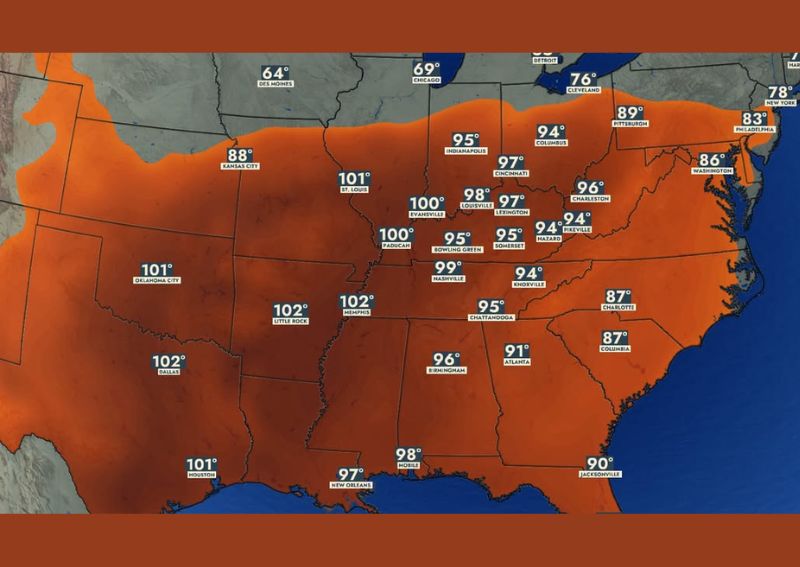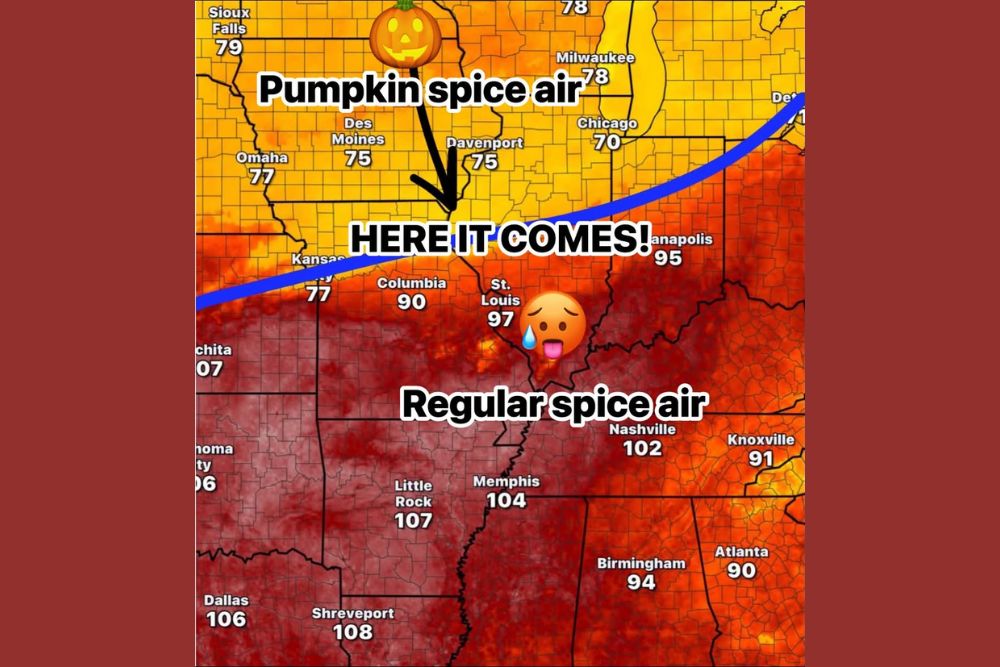
BIRMINGHAM, AL — Alabama remains locked in a stubborn holiday weekend heat pattern as a persistent upper-level ridge keeps afternoon high temperatures in the mid to upper 90s across much of the state, with forecast data showing little relief on the horizon and only scattered relief from isolated afternoon showers and storms expected during the peak heat of the day.
A Holding Pattern Settles Over the State
Daily high and low temperature projections out of Birmingham-Shuttlesworth International Airport show highs staying remarkably consistent through the coming days, ranging from 91 to 97 degrees through the holiday weekend and into the following week, with overnight lows only dipping into the low-to-mid 70s. That narrow temperature range reflects just how entrenched the current weather pattern has become, with the upper ridge responsible for the heat showing little sign of budging as the calendar moves deeper into September.
Limited Storm Chances Offer Only Brief Relief
The primary source of any relief from the persistent heat comes in the form of afternoon showers and thunderstorms, though forecasters emphasized these will remain isolated rather than widespread. The odds of any single location seeing rain on a given day were placed at 20 to 30 percent for the southern quarter of the state, while the remainder of Alabama carried roughly a 20 percent chance, meaning the majority of the state and most locations within it are more likely than not to stay dry even as scattered storms pop up elsewhere.
These afternoon storms typically develop during the hottest part of the day, driven by daytime heating interacting with whatever modest moisture is available in the atmosphere, a classic summertime convective pattern that persists even as the calendar transitions toward fall. While these storms can offer brief, localized cooling and rainfall, their scattered and isolated nature means most communities across the state will continue experiencing the full brunt of the heat on any given afternoon.
Extended Outlook Shows No Meaningful Change
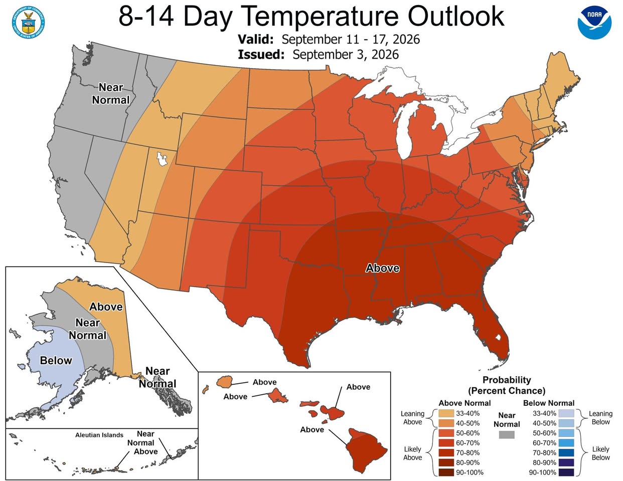
Longer-range forecast guidance offers little encouragement for anyone hoping the heat will break soon. The 8-to-14-day temperature outlook, valid for the period of September 11 through 17, shows Alabama and much of the surrounding Southeast and Mid-South falling within the highest probability category for above-normal temperatures, with likelihood values reaching into the 80 to 90 percent range across large portions of the state on the outlook’s probability scale.
This extended signal reinforces what the near-term forecast already suggests: the ridge responsible for the current heat pattern is not a brief, isolated event but rather a more entrenched feature likely to keep influencing Alabama’s weather for at least the next two weeks. Forecasters noted that next week’s weather is expected to closely resemble the pattern currently in place, with highs remaining in the 90s and afternoon storm activity staying isolated rather than becoming more organized or widespread.
Why the Pattern Has Proven So Persistent
Upper-level ridges like the one currently anchored over the Southeast function as a kind of atmospheric roadblock, deflecting stronger storm systems and cooler air masses away from the region while allowing heat to build day after day underneath the dome of high pressure. These patterns can be remarkably stable once established, particularly in early September when the broader seasonal transition toward fall has not yet gained enough momentum to dislodge a well-entrenched ridge.
The result is a weather pattern that essentially repeats itself with only minor variations from one day to the next, a scenario reflected clearly in the consistency of the projected daily highs, which show barely any meaningful day-to-day fluctuation despite spanning more than a week of forecast data.
When Might Real Change Arrive
Forecasters indicated that residents hoping for the first genuine taste of fall weather will likely need to wait until sometime in late September before a decent frontal system finally breaks through the stubborn ridge and delivers more meaningful cooling. Until then, the pattern of hot afternoons, warm overnight lows, and only isolated storm chances appears set to continue with little interruption.
Residents across Alabama are encouraged to continue taking heat precautions through the holiday weekend and into the following week, including staying hydrated and limiting prolonged outdoor exertion during peak afternoon heat, given that meaningful relief from the current pattern remains several weeks away.
For continuing coverage of severe weather events and critical storm analysis across the United States, visit svhsnow.com.