HILO, HI — Hurricane Lowell rapidly intensified into a monster Category 5 storm on Wednesday, reaching the very top of the Saffir-Simpson scale as it churned roughly 445 miles south of Hilo and began sending dangerous swells toward the Hawaiian Islands, even as forecasters stressed the powerful hurricane remains well south of land for now.
Lowell Rockets to the Top of the Scale
Lowell’s intensification came in rapid fashion, with the storm hitting 155 mph earlier in the day before strengthening even further to sustained winds of 160 mph and a central pressure that dropped to 927 millibars, according to the Central Pacific Hurricane Center. The hurricane was tracking west at approximately 10 mph as of the latest advisory, with hurricane-force winds extending up to 35 miles from the center and tropical-storm-force winds reaching out to 90 miles.
A Rare and Extremely Well-Organized Storm
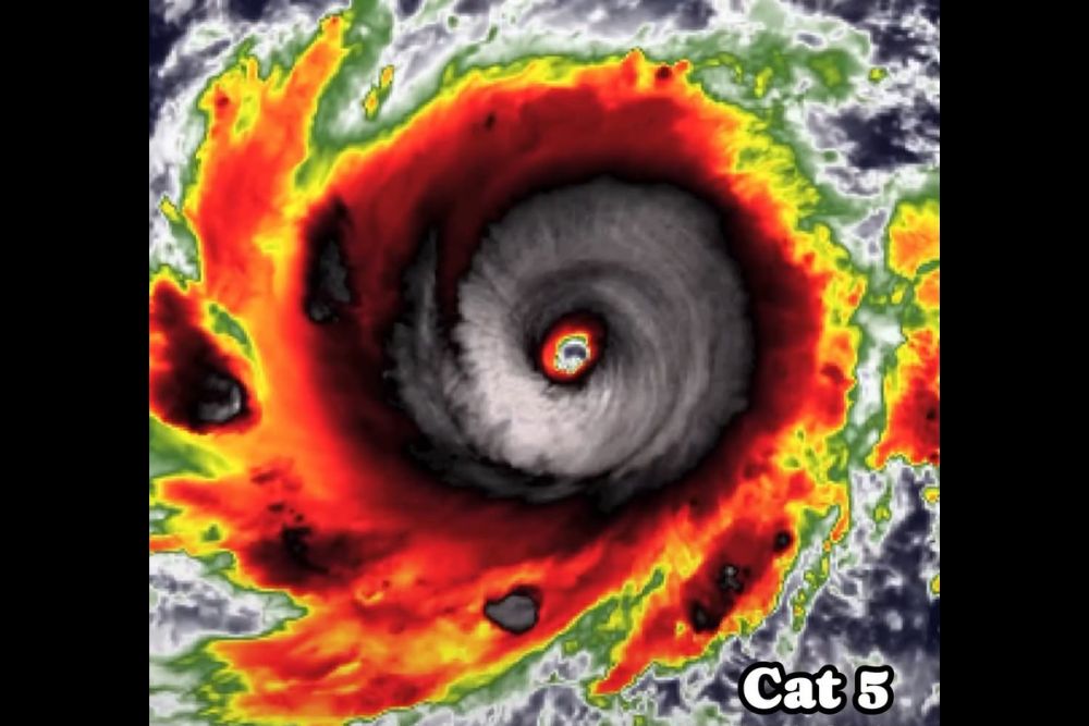
Satellite imagery of Lowell has shown an extremely well-defined eye, a hallmark of an intensely organized and powerful hurricane. Forecasters describe the storm as compact but formidable, with a symmetric ring of deep convection surrounding the eye and cloud-top temperatures cold enough to indicate an exceptionally strong and efficient storm engine. Category 5 hurricanes are considered rare in the Central Pacific basin, making Lowell’s rapid climb to the top of the intensity scale a notable meteorological event even before any consideration of its eventual track.
The Central Pacific Hurricane Center noted that conditions across the region remain highly favorable for Lowell to maintain or even increase its current intensity, citing very high oceanic heat content beneath the storm combined with low wind shear in the surrounding atmosphere. Forecasters expressed high confidence that Lowell will remain a major hurricane, meaning Category 3 strength or higher, through the remainder of the week as it continues tracking across the open waters of the Central Pacific.
Hawaii Begins Feeling Lowell’s Reach
While Lowell itself remains hundreds of miles from land, its effects are already being felt across the Hawaiian Islands in the form of surf and ocean conditions. Large swells generated by the hurricane are spreading northward and are expected to produce life-threatening surf and dangerous rip currents along Hawaiian shorelines over the coming days, even with no coastal watches or warnings currently in effect for any of the islands.
The National Weather Service in Honolulu has already issued guidance related to elevated surf tied to Lowell’s swells, with wave heights along exposed south- and east-facing shores expected to climb as the hurricane’s energy propagates outward ahead of the storm itself. Ocean safety officials are urging beachgoers across the islands to exercise increased caution given how quickly rip currents generated by distant hurricanes can turn deadly, even on days when the weather on land appears calm and unaffected.
Uncertain Long-Range Track Keeps Hawaii Watching
Lowell’s forward motion is expected to gradually slow over the coming days as it continues moving generally westward, staying well to the south of the Hawaiian Islands during that stretch. However, forecasters anticipate a significant change in the storm’s steering pattern later in the week, one that could cause Lowell to make a sharp turn toward the north or north-northeast as it approaches the longitude of the islands.
Considerable uncertainty remains regarding exactly how sharp that eventual turn will be and how close the resulting track might bring Lowell to the islands, with some recent forecast guidance trending the longer-range track closer to Hawaii than earlier runs had indicated. Local officials, including Honolulu’s mayor, have urged residents to use the current window of time productively, monitoring the forecast closely and reviewing preparedness plans even though any potential direct impacts remain several days away at the earliest.
What Comes Next for the Islands
For now, the primary tangible impact from Lowell across Hawaii remains confined to the ocean, with dangerous surf and rip currents expected to persist and potentially intensify as the swells continue arriving over the next several days. Emergency officials continue to emphasize that residents should not need to make immediate preparations beyond staying informed, given that any direct wind or rain impacts from the hurricane itself would depend heavily on how the storm’s track evolves once it begins its anticipated turn.
Meteorologists will continue monitoring Lowell’s intensity, structure, and track closely in the coming days, particularly as it approaches the point in the forecast where its motion is expected to shift, a period that will offer far greater clarity on whether the islands face any direct impacts from what is currently one of the most powerful hurricanes on the planet.
For continuing coverage of severe weather events and critical storm analysis across the United States, visit svhsnow.com.