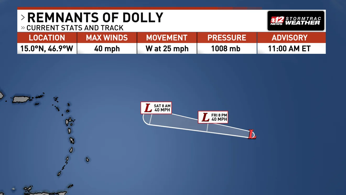
WEST PALM BEACH, FL — Tropical Storm Dolly dissipated Friday morning, and the National Hurricane Center issued its final advisory on the system. Even without a closed center of circulation, the former storm is still expected to send gusty winds and heavy rain across parts of the Caribbean this weekend.
Satellite imagery showed no westerly winds south of Dolly’s center, confirming the storm no longer had the structure needed to remain a tropical cyclone. Forecasters say its remnants will keep moving quickly west over the next couple of days, pushed along by a strong ridge of high pressure in the central Atlantic.
What forecasters say will happen next
Dolly is not expected to rebuild as it crosses warmer ocean water. Forecasters say stronger wind shear, relatively dry air and the storm’s fast forward motion should keep the system from restrengthening into a tropical storm.
Even so, the main hazard now appears to be rain. Heavy rainfall from the remnants could reach the Leeward Islands late Saturday into Sunday, with the Virgin Islands, Puerto Rico and Hispaniola seeing impacts Sunday into Monday. The timing puts several island areas under the threat of unsettled weather through the first part of the week.
Because the system is moving quickly, the rain may arrive in bursts rather than as a long-lived event. That can still be enough to create dangerous conditions where the heaviest bands set up.
Where flooding could be the biggest concern
Flash flooding is the main concern, especially in the Leeward Islands, where steep terrain can force water downhill fast into valleys and low-lying communities. Meteorologists say mountainous areas are especially vulnerable when tropical moisture produces short periods of intense rainfall.
Residents across the northeastern Caribbean are being urged to keep monitoring the system through the weekend, even though Dolly has lost tropical storm status. The storm’s moisture could still bring periods of heavy rain and gusty winds to multiple islands as it passes west.
That combination of saturated bursts of rain and terrain-driven runoff can make flooding develop quickly during or shortly after downpours. In the Caribbean, those conditions can change rapidly from one island to the next.
Florida could see more rain by Thursday
The weather system may not be done affecting the U.S. Yet another round of moisture associated with Dolly could reach Florida by the middle of next week, with rain chances increasing by Thursday.
Forecasters say the Florida impact is still dependent on how the remnants hold together and track across the Atlantic, but the signal for added moisture is enough to keep attention on the state’s weather later in the week.
For now, the immediate threat remains farther east in the Caribbean, where heavy rain and flash flooding are the main concerns from late Saturday into Monday.
When the weather turns dangerous, SVH Snow is watching.