SOUTHEAST SOUTHWEST LOUISIANA — Tropical Storm Edouard came ashore a little after 12:30 p.m. near the Texas-Louisiana state line, close to Johnson Bayou, Louisiana. The storm reached land with peak winds around 60 mph.
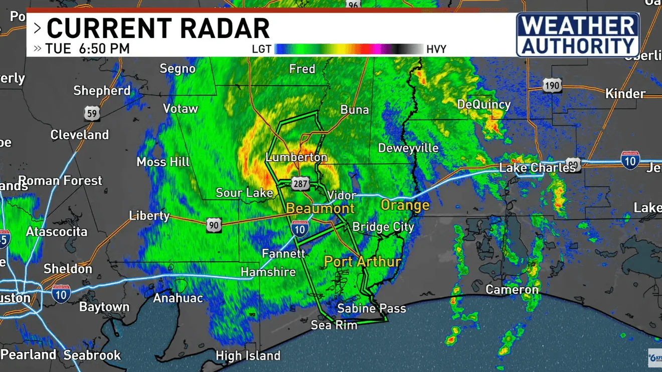
Forecasters say the main near-term concern is rounds of heavy rain as outer bands and rain bands move across the region. Beaumont and areas to the west and northwest are expected to see periods of heavier rainfall as the system pushes inland.
The storm is being tracked closely across Southeast Texas and southwest Louisiana, where conditions can change quickly as rain bands rotate through. Residents in the path of the weather system are being told to monitor updates from local forecasters.
Rain bands target Beaumont and nearby areas
The weather threat is not limited to the immediate landfall zone. As Edouard moves inland, bands of rain are expected to sweep across communities on both sides of the state line, with Beaumont singled out for repeated periods of heavy rain.
That setup can lead to reduced visibility, brief street flooding, and rapid changes in conditions as one band moves out and another moves in. The strongest impacts described so far center on rainfall, not a major wind event, though the storm is still producing tropical-storm-force conditions near the core.
People in flood-prone spots are the ones most likely to notice the first effects. Even when winds ease, repeated downpours can create problems that build over time, especially if the rain falls in bursts through the afternoon and evening.
What the landfall means right now
Landfall near the state line means the center of the storm has crossed from open water onto land and will continue to weaken gradually as it moves inland. The timing matters because the heaviest rain can shift quickly depending on the storm’s track and speed.
At this stage, the forecast focus is on where the rain bands set up rather than on a broad swath of damaging wind. The system is close enough to the coast to keep weather conditions unstable across the upper Texas coast and southwest Louisiana.
For anyone heading out, the practical message is simple: expect a wet and unsettled afternoon, and keep an eye on local alerts if travel takes you through Beaumont or the surrounding counties and parishes.
How residents should prepare for the next several hours
With tropical weather already onshore, officials and forecasters are urging people to stay tuned for the latest updates as the storm continues to move. The situation can evolve quickly, especially if heavier rain bands stall over one area.
Drivers should be ready for changing road conditions, and anyone in low-lying areas should pay attention to water rising on streets or near homes. Even a storm with winds around 60 mph can create outsized disruption when heavy rain persists for several hours.
The clearest takeaway is that Edouard is no longer an offshore system: it is now a landfalling tropical storm affecting communities near the Texas-Louisiana line, with rain becoming the most immediate concern for Beaumont and nearby parts of the Gulf Coast.
When the weather turns dangerous, SVH Snow is watching.