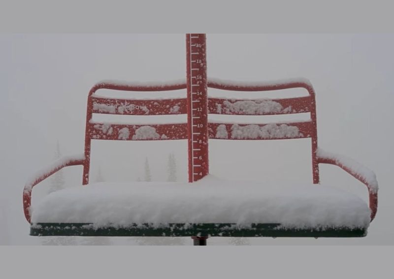
BOZEMAN, MT — New pictures coming in this morning show over 3 inches of summer snow blanketing portions of western Montana, stretching from Bridger Bowl near Bozeman all the way to Logan Pass in Glacier National Park. The unexpected wintry scene has transformed the landscape into what forecasters are calling a September winter wonderland, catching many off guard given the time of year.
Bridger Bowl Sees a Significant Early Snowfall
Photos from Bridger Bowl, the popular ski area near Bozeman, show a thick blanket of fresh snow coating trees, buildings, and the surrounding terrain, with the snowfall reducing visibility to near whiteout conditions in some images. The scene, more typical of a winter ski day than a mid-September morning, illustrates just how substantial this particular snowfall event has become for the area.
Given Bridger Bowl’s status as a well-known winter recreation destination, this kind of early-season snowfall often generates significant interest among skiing and snowboarding enthusiasts eager for signs of the approaching winter season, even though this particular event remains an unusual, out-of-season occurrence rather than a signal of the true ski season’s arrival.
Logan Pass and Glacier National Park Show Dramatic Scenes
Images from Logan Pass, located within Glacier National Park, show snow-covered forests and a measuring stake documenting the accumulation, with the surrounding mountainous terrain nearly obscured by falling snow and low clouds. The photos, shared by the Glacier National Park Conservancy, capture the dramatic transformation of the high-elevation landscape within just a matter of hours.
The combination of heavy, wet snow clinging to evergreen trees and thick fog reducing visibility across the pass creates scenes more reminiscent of a January storm than a September morning, highlighting the unusual nature of this particular weather event for the region.
Elevation Plays a Key Role in the Snowfall
Both Bridger Bowl and Logan Pass sit at significant elevation, a common factor explaining why these particular locations are experiencing measurable snowfall while lower-elevation areas across Montana likely remained rain-affected or entirely dry during the same weather system. High-elevation terrain frequently sees precipitation fall as snow even during periods when valley floors and lower communities receive only rain.
This elevation-dependent pattern is a routine feature of mountain weather, particularly in a state like Montana with such dramatic terrain variation, where a single storm system can produce vastly different precipitation types depending on how high above sea level a specific location sits.
An Unusual Sight for Mid-September
While Montana’s higher elevations are certainly no stranger to snow, even during the summer months, more than 3 inches of accumulation this early in September represents a notably significant event for the region. The timing, arriving well before the traditional start of the ski season, adds to the surprising nature of this particular snowfall for residents and visitors throughout the affected mountain areas.
This kind of early snow event, while not entirely unprecedented for Montana’s high country, still stands out enough to generate widespread interest and photo-sharing among residents and organizations like the Glacier National Park Conservancy, eager to document the striking early-season wintry scene.
What This Means for the Region
This surprise snowfall serves as an early reminder that winter weather can arrive at Montana’s higher elevations well ahead of the broader seasonal transition affecting the rest of the country. For those planning visits to high-elevation areas like Logan Pass or mountain recreation zones such as Bridger Bowl, this event underscores the importance of being prepared for rapidly changing and potentially wintry conditions, even during what is technically still meteorological summer transitioning into fall.
Residents and visitors to Montana’s mountain regions should continue to monitor forecasts closely, as similar early-season snow events remain possible at these elevations as the state moves further into the fall transition period.
For continuing coverage of severe weather events and critical storm analysis across the United States, visit svhsnow.com.