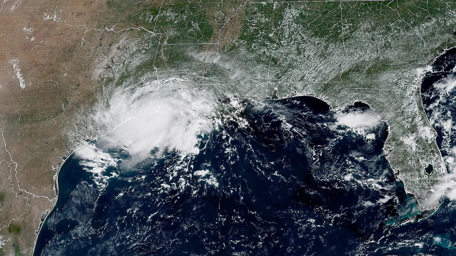
HOUSTON, TX — Tropical Storm Edouard made landfall Tuesday afternoon and is now pushing heavy rain toward southeast Texas and southwest Louisiana. Forecasters say the main concern will last through Wednesday, with flooding rainfall posing the greatest threat.
The storm is also bringing the risk of a 1-to-3 foot storm surge along the coast. Wind gusts could reach 60 mph, and a tornado or two cannot be ruled out Tuesday afternoon and evening in parts of southwest Louisiana and southeast Texas.
Rainfall is the biggest danger
Rain totals could quickly become serious near the Texas coast, where 2 to 4 inches are expected. Farther inland, areas north of Houston could pick up 6 to 9 inches of rain, according to the forecast.
That kind of rainfall can overwhelm drainage systems and flood streets, especially in low-lying neighborhoods and other urban areas. Even where wind damage stays limited, fast-moving downpours can create sudden hazards for drivers and residents.
Officials are warning that flash flooding is the main threat from this storm. The rain may fall in bursts through Wednesday, raising the chance that water collects faster than it can drain away.
Where the storm is expected to hit hardest
Southeast Texas and southwest Louisiana are in the core impact zone, with conditions expected to worsen as Edouard moves inland. Coastal communities face the combined risk of surge, heavy rain, and stronger wind, while inland areas may see the highest rainfall totals.
North of Houston, the forecast calls for the largest rain amounts, which could lead to localized flooding in neighborhoods, underpasses, and other flood-prone spots. Along the immediate coast, even lower rainfall totals can become dangerous when they fall on already saturated ground.
The tornado threat is limited, but it is still part of the forecast for Tuesday afternoon and evening. Residents across the warning area should stay alert for rapid changes in conditions as the storm continues to move through the region.
What residents should watch through Wednesday
People in the storm zone should be prepared for periods of heavy rain, gusty winds, and possible coastal flooding through Wednesday. The forecast suggests the weather will remain unsettled long enough for repeated rounds of rain to cause trouble in the same places.
Because flash flooding can develop quickly, low-lying roads and urban streets may become unsafe with little warning. In the hardest-hit areas, water could rise fast enough to trap vehicles or cut off access to homes and businesses.
Residents should keep an eye on local alerts and be ready for changing conditions through the middle of the week. Even after the strongest winds pass, rainfall impacts may continue to build as Edouard moves away.
When the weather turns dangerous, SVH Snow is watching.