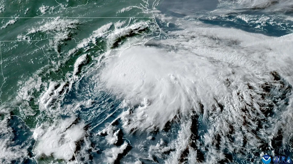
HONOLULU, HI — Tropical Storm Lowell has formed in the Eastern Pacific and is being watched for a possible run toward Hawaiian waters in early September. Forecasters say the system is still far away from the islands, but its track could bring it closer during the week of Sept. 6 to 11 if steering winds evolve in the right way.
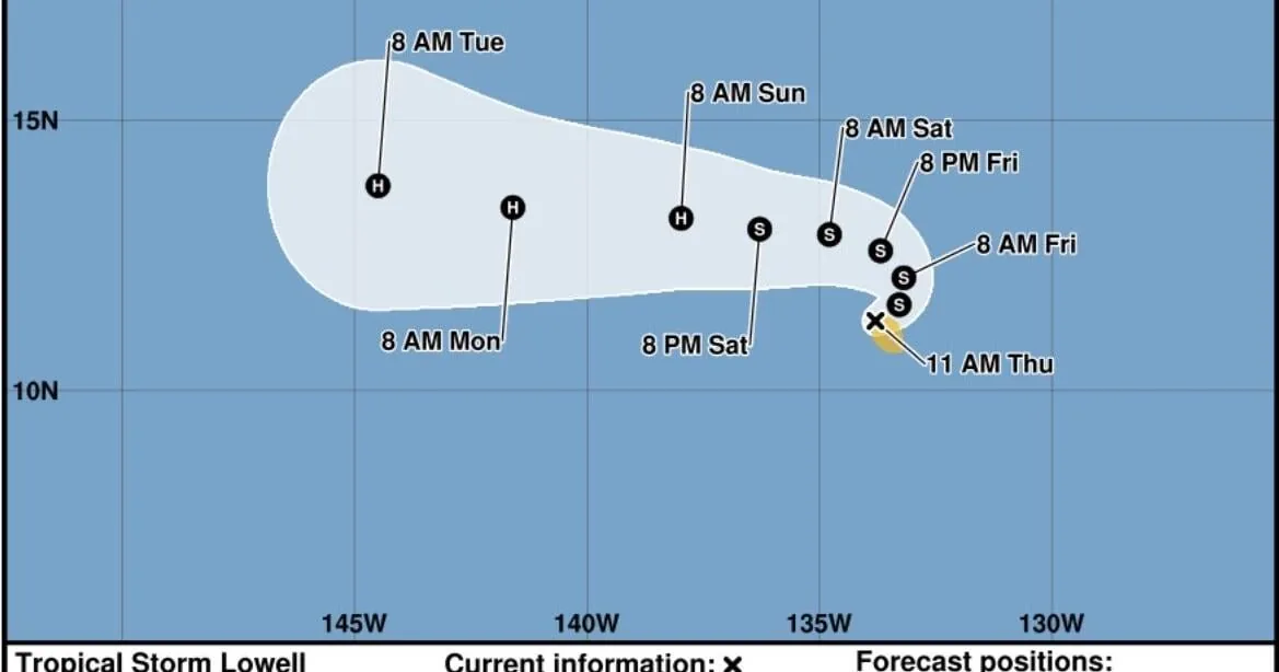
Lowell was packing 40 mph winds and was moving east-northeast at about 5 mph. For now, there are no watches or warnings in effect, and officials say no hazards are expected immediately. The storm remains an offshore weather feature, but its path and strength will depend on how the larger weather pattern sets up over the next several days.
What forecasters expect next
The current forecast calls for Lowell to gradually turn north before bending back toward the west this weekend. That kind of motion would keep it in a slow-moving, evolving track across the Pacific while forecasters watch whether it gains enough organization to strengthen further.
Some intensification is expected over the next few days, and Lowell could become a hurricane by Saturday night. That projection makes the storm worth monitoring even though it is not yet an immediate threat. Changes in speed, direction, or surrounding winds could alter the outlook for Hawaii, which is why meteorologists are watching the system closely.
Why Hawaii is watching this system
Lowell is not currently impacting the islands, but its long-range track places Hawaii in the area of interest for forecasters. The key question is whether the storm stays on a path that keeps it well offshore or shifts in a way that brings it into the islands’ broader weather zone during the second week of September.
At this stage, the concern is not for immediate damage or dangerous conditions. Instead, it is a watch-and-wait situation driven by the uncertainty of Pacific steering winds. If those winds change, the storm’s route could change with them, which is why forecasts may continue to move over the coming days.
What residents should know now
For now, officials say there is no need for alerts, but residents should keep an eye on updated forecasts as Lowell develops. The storm is expected to stay active enough to merit attention, especially if strengthening continues and the track becomes more favorable for a Hawaiian approach.
That means the most important timing to watch is the Sept. 6 to 11 window, when Lowell could be near Hawaiian waters depending on the evolving pattern. Even with no warnings posted today, the combination of slow movement, possible strengthening, and an uncertain steering setup leaves the situation open to change quickly.
When the weather turns dangerous, SVH Snow is watching.