ORLANDO, FL — Tropical Storm Dolly formed in the Atlantic Thursday morning, according to the National Hurricane Center, setting off the usual round of forecast watches, maps and model tracking for anyone following the system’s next move.
WESH is directing viewers to bookmark its storm-tracking page for the latest NHC maps and model runs. The station also says its First Warning Weather team will keep updating forecasts for Central Florida as conditions change.
At this stage, the main focus is not on landfall but on how the storm organizes and where the guidance trends in the coming hours and days.
What the National Hurricane Center is watching
The National Hurricane Center is the lead agency following Dolly’s development in the Atlantic. When a tropical storm first forms, forecasters typically use satellite data, storm centers, and computer model guidance to judge strength and movement.
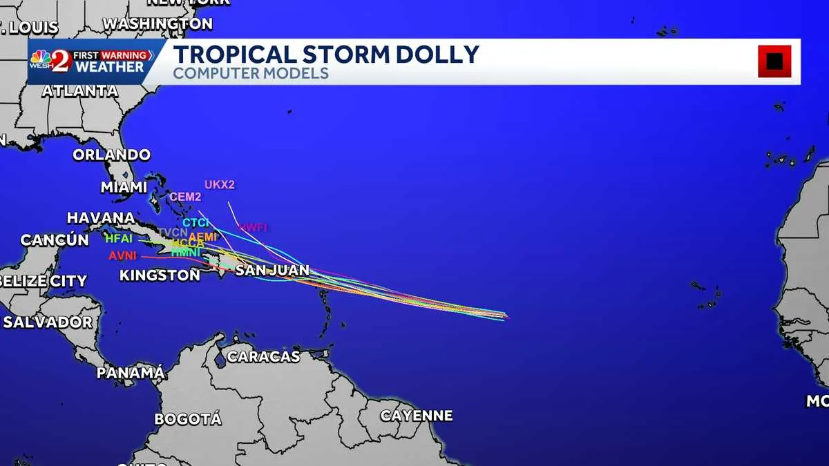
That is why WESH is highlighting maps and “spaghetti models,” the cluster of forecast tracks that can show where different models think the storm might go. The models are not a prediction by themselves, but they give viewers a sense of spread and uncertainty.
For now, the confirmed fact is that Dolly exists as a tropical storm and is being monitored in real time. No specific impacts for Central Florida were described in the update, and the key variable will be how the storm behaves over the Atlantic.
How WESH says viewers should follow updates
WESH says its coverage will continue online and on air through the station’s Tracking the Tropics and First Warning Weather platforms. The station says the goal is to provide the most accurate Central Florida forecast as the system develops.
Viewers are also being pointed to the WESH 2 News app for the latest weather alerts. The station’s weather team includes Chief Meteorologist Tony Mainolfi, Eric Burris, Cam Tran, Victoria Wisniewski and Luke Vickery.
WESH is also promoting related hurricane-season resources, including its long-range forecast, insurance information, generator setup guidance and post-storm resources. Those links are part of the station’s broader storm-season coverage rather than a warning about any one immediate threat.
Why this matters for the Atlantic hurricane season
Dolly’s formation adds another named system to the 2026 hurricane season, which is already underway and being closely watched by forecasters and coastal residents. Even when a storm is far from the United States, its track can still shift quickly and affect how people prepare.
For Florida readers, the important point is to keep an eye on official forecasts instead of model chatter alone. The National Hurricane Center and local meteorologists will update the storm’s status as the situation changes, and that could include changes to intensity, path or timing.
WESH says it will keep updating its maps and forecast tools as new information comes in. For now, Dolly is the system to watch, and the next model cycles will matter most.
When the weather turns dangerous, SVH Snow is watching.