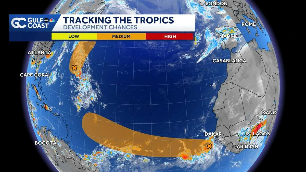
BONITA SPRINGS, FL — Forecasters on the Gulf Coast are watching two tropical disturbances in the Atlantic, and both currently carry medium odds of development. The National Hurricane Center and the Gulf Coast Hurricane Tracking Team are monitoring the systems as the heart of hurricane season approaches.
One disturbance is Invest 96L, a tropical wave moving off the west coast of Africa. The other is Invest 95L, a weak low-pressure area a few hundred miles southeast of Bermuda. Designating a system as an invest simply means it gets extra data collection and closer attention; it does not mean a storm is guaranteed.
If either system organizes enough, the next named storm on the Atlantic list would be Dolly.
What forecasters say about Invest 96L
Invest 96L is the more eastern system, and it is moving west at about 15 to 20 mph through warm Atlantic waters. The National Hurricane Center gives it a 40 percent chance of development over the next two days and a 60 percent chance over the next seven days.
That system could become a tropical depression by the middle of the week as it reaches the central tropical Atlantic. For now, the main concern is whether the disturbance can stay organized while it continues its westward trek. Forecasters will be watching for stronger rotation, more persistent thunderstorms, and signs that the system is beginning to close off a center of circulation.
The timing matters because the Atlantic remains active enough to support development, especially as the season moves deeper into August and toward its statistical peak in early September.
What forecasters say about Invest 95L near Bermuda
Invest 95L is sitting in the western Atlantic near Bermuda, where it could briefly strengthen before conditions turn less favorable. The latest outlook gives it a 50 percent chance of development in both the next two days and the next seven days.
Forecasters say the disturbance could become a short-lived tropical depression or tropical storm by Tuesday as it drifts north. By Wednesday, it is expected to move into cooler sea surface temperatures, which should shut down its window for tropical development.
Even if it organizes, the system is not expected to threaten Florida. That makes its main impact one of monitoring rather than direct landfall concern, although forecasters will continue to track its movement and structure closely as it passes through the open Atlantic.
Why this week matters for the Atlantic season
If a named storm forms, Dolly would be the next name used this year. That would mark another step in a season that often gains momentum as August ends and September nears. The historic peak of Atlantic hurricane activity is September 10, and forecasters often watch the weeks leading up to that date closely.
For now, the key takeaway is that the basin is active, but neither disturbance has been declared a storm. That means residents from the Gulf Coast to the broader Atlantic basin should keep checking updates, especially if one of the systems organizes faster than expected.
Gulf Coast forecasters say they will continue tracking the disturbances through the week and providing updated guidance as conditions change.
When the weather turns dangerous, SVH Snow is watching.