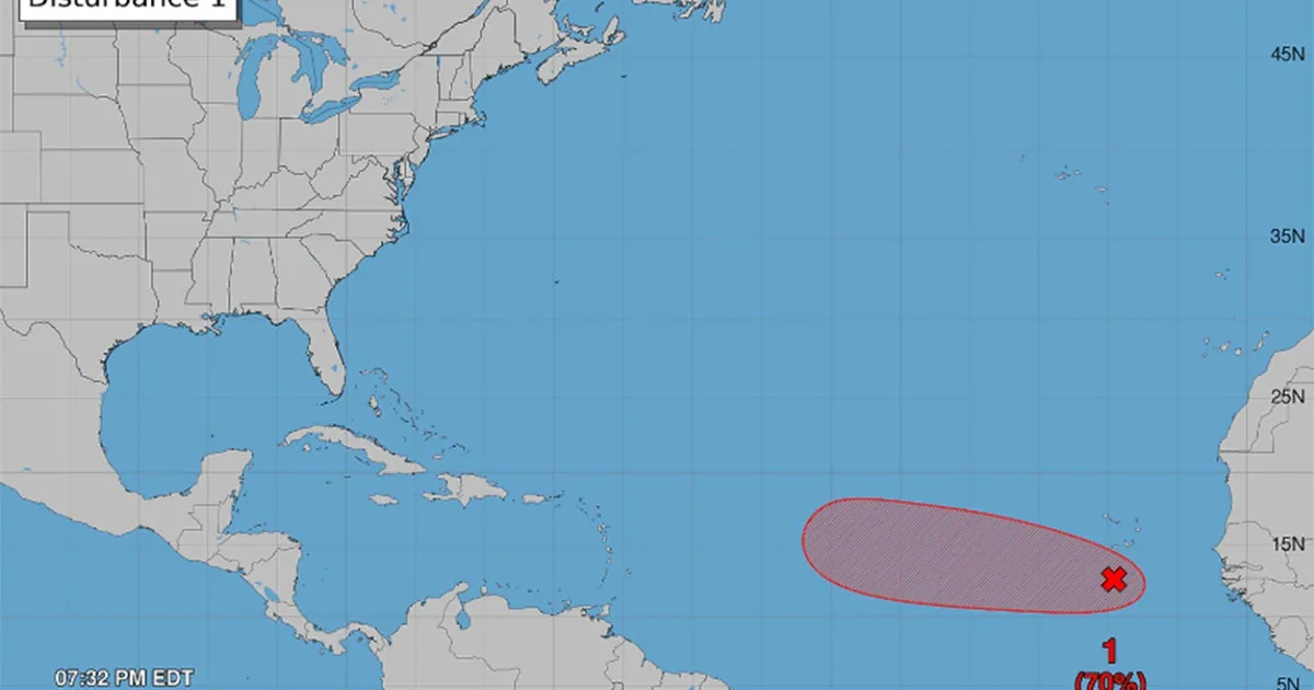
ORLANDO, FL — Forecasters are watching an area of low pressure in the eastern Atlantic that could organize into a tropical depression within the next two days. If that happens and the system strengthens further, the next named storm in the Atlantic would be Dolly.
The name is a coincidence and has nothing to do with Dolly Parton. Tropical cyclone names are assigned from a pre-set alphabetical list, and only the names beginning with A, B and C have been used so far this year because there have been just three named Atlantic storms.
How the Name Dolly Fits the Season
Storm names are chosen years ahead of time by the World Meteorological Organization. The agency says the names are meant to make storms easier to identify, remember and warn about, not to honor any particular person or follow a celebrity connection.
Because the Atlantic list moves alphabetically, the next system to reach named-storm strength would take the D name. In 2026, that means Dolly. The same list also contains future names already set for later years, such as Dexter for the fourth named storm of 2031 and Van if that season reaches a 25th storm.
What Forecasters Are Seeing Now
The National Weather Service says the disturbance is producing showers and thunderstorms near the Cabo Verde Islands. In its Tuesday evening update, the agency said a tropical depression is likely to form within the next couple of days, but it has not said whether the system will reach tropical storm strength.
That distinction matters because a depression can still fall short of being named. If the low-pressure area organizes more quickly and winds increase enough, the storm would become Dolly. For now, the system is only under watch, and forecasters are still monitoring how quickly it develops over the eastern Atlantic.
Why the Development Matters
Early-season tracking like this gives forecasters time to warn about a system before it becomes more dangerous. Even when a storm is still several steps away from being named, agencies use the watches and updates to help people follow potential changes in strength and track.
The current outlook does not confirm that Dolly will form, only that the ingredients are there for development. The next one to two days will show whether the disturbance stays weak, becomes a tropical depression, or organizes enough to earn the next Atlantic name.
When the weather turns dangerous, SVH Snow is watching.