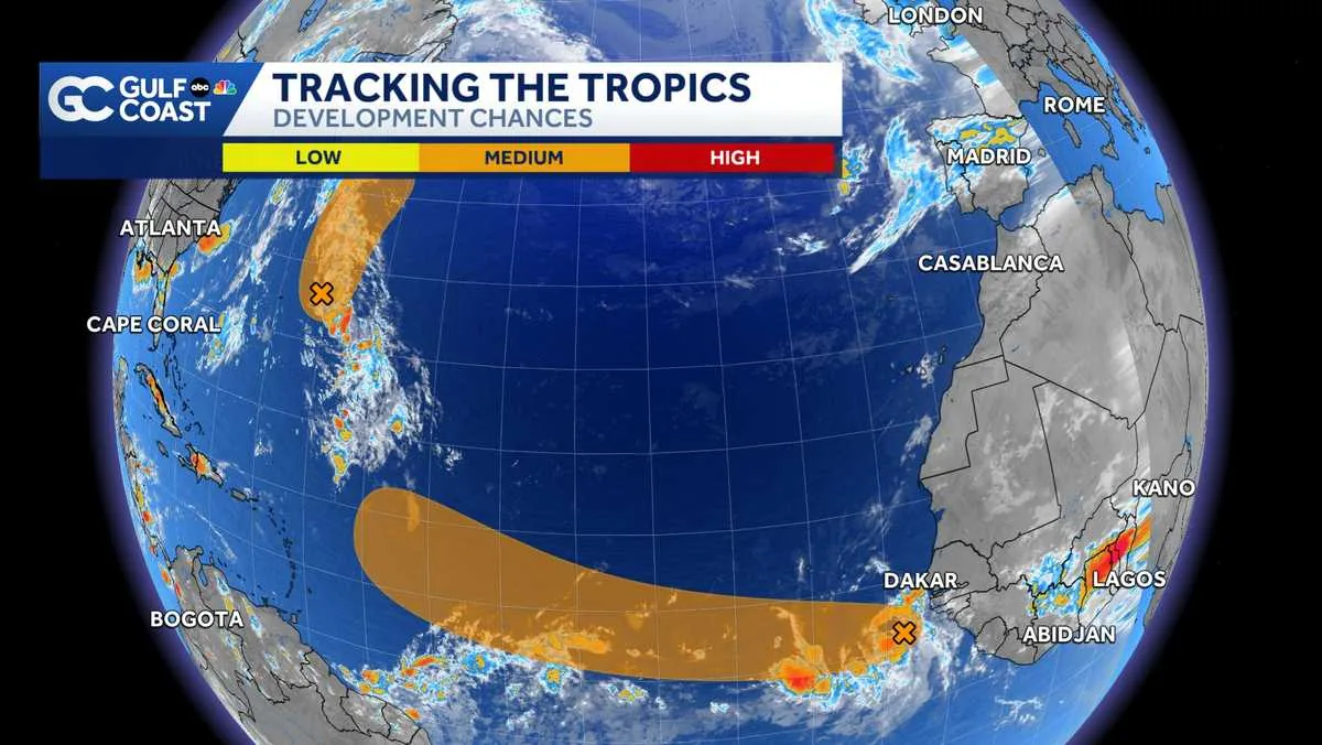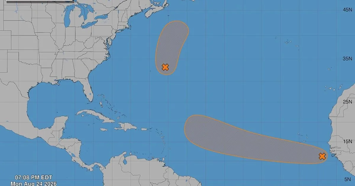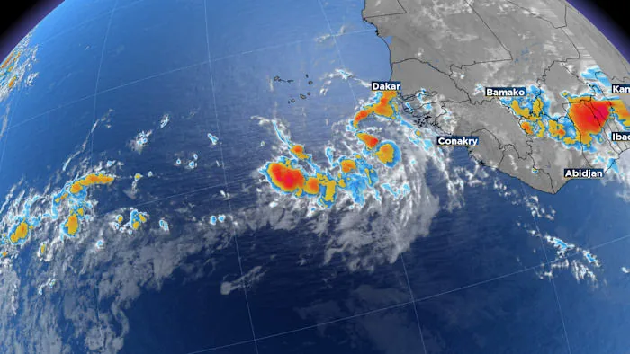
ORLANDO, FL — A tropical wave that moved off Africa early Monday is now being tracked as Invest 96L, and the National Hurricane Center has begun running specialized tropical models on it.
Early Monday evening guidance points the disturbance west-northwest across the central Atlantic. Even so, the system is still in the early stages, and dry air plus a stable atmosphere are expected to slow organization for now.
The setup matters for U.S. readers because any future track would be shaped in part by a separate weather system expected to move off the East Coast and help steer the disturbance away from land. Forecasters say that is still a long-range idea, not a near-term threat.
What the early model runs suggest
For now, the first batch of models splits 96L into two broad possibilities. One scenario keeps the system weaker as it passes near the Caribbean islands. The other turns it farther east and out to sea before it can pose a closer threat.
The National Hurricane Center says the disturbance currently has a 60% chance to develop over the next seven days. That is a meaningful chance, but it does not mean rapid strengthening is imminent. Forecast confidence remains limited because the system has yet to organize well.
If the disturbance survives longer and ends up in the corridor between Puerto Rico and Bermuda, it would have a better chance to strengthen. That area can favor development when the surrounding atmosphere becomes more supportive.
Why Florida and the East Coast are watching
Florida is not in the immediate danger zone, but the state is part of the longer-range forecast discussion because steering patterns over the Atlantic often determine whether a system curves harmlessly away or keeps moving west.
Forecasters say the likely exit of another system from the U.S. East Coast could help guide 96L away from the mainland. That is one reason the initial outlook leans toward an eventual turn out to sea, even though the details are still uncertain.
The key point right now is timing. The disturbance is still far from the United States, and it should only gradually take shape as the week unfolds. Residents along the East Coast, including Florida, will want to keep checking updates as model guidance improves.
Another disturbance near Bermuda also has a short window
A separate system, Invest 95L, is sitting near Bermuda and has a 50% chance of development over the next seven days. Its window appears to be closing quickly, because another weather system moving off the Northeast U.S. is likely to absorb it.
That means 95L may never get much time to organize before being overtaken by larger-scale weather features. By contrast, 96L has the more notable long-range potential, even though it is still early and conditions are not yet favorable for a quick ramp-up.
The next named storm of the 2026 Atlantic hurricane season would be Dolly. For now, forecasters are emphasizing that both systems are still far from any direct U.S. impact, and the forecast can change as new model runs come in.
When the weather turns dangerous, SVH Snow is watching.