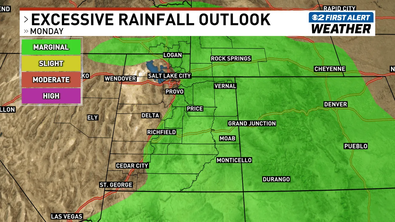
SALT LAKE CITY, UT — More thunderstorms are expected across Utah on Monday after a stormy Sunday left the state dealing with another round of unstable weather. Forecasters say northern Utah has a marginal risk, or Level 1 out of 5, for severe weather during the afternoon and evening.
The bigger concern in some parts of the state is heavy rain and the chance of flash flooding. Recreation areas in southern and central Utah remain at risk, especially where storms can dump water quickly on dry ground or in narrow canyons and washes.
Temperatures are also climbing back up, with highs reaching the 90s along the Wasatch Front. St. George is expected to reach 103 degrees Monday.
Flash flood threat stays focused on recreation areas
Officials and forecasters are warning that the flood risk is not spread evenly across the state. The areas most likely to see problems are popular outdoor spots in southern and central Utah, where visitors may be exposed if storms develop suddenly and rain falls hard over a short period.
That setup can turn dangerous fast in slot canyons, low-water crossings and other places where runoff can surge with little warning. Even storms that do not last long can still create fast-moving water and muddy conditions that catch hikers, campers and drivers off guard.
Residents and visitors are being urged to pay close attention to changing skies and weather alerts before heading out. The combination of heat, unstable air and leftover moisture is what keeps the flash flood threat in play.
Northern Utah has a small severe weather window Monday
In northern Utah, the severe weather outlook is only marginal, but it still points to a possible afternoon and evening period when storms could become stronger. That means isolated storms may produce lightning, gusty winds and brief heavy downpours even if most locations do not see widespread severe conditions.
Because the threat is limited, not every community will necessarily be hit. Still, residents should be ready for quick changes in weather, especially during the hours when storms are most likely to build.
Monday’s storm chance follows a very active Sunday, but the pattern is not expected to stay wet all week. Forecasters say the state should begin drying out by midweek and remain drier through the first part of the weekend.
A few storms may linger Tuesday before drying begins
Some leftover storms are still possible on Tuesday, so the weather pattern will not shut off immediately. Even after the main round passes, a few scattered showers or thunderstorms could hang around long enough to keep localized flooding concerns going in isolated spots.
After that, the forecast trends calmer. Midweek is expected to bring a break from the more active storm pattern, and that quieter stretch should continue into the first part of the weekend.
For now, the main issues remain short-term severe weather in northern Utah, flash flood risk in recreation areas farther south and east, and hot afternoon temperatures that will make the air feel more like late summer than early fall.
When the weather turns dangerous, SVH Snow is watching.